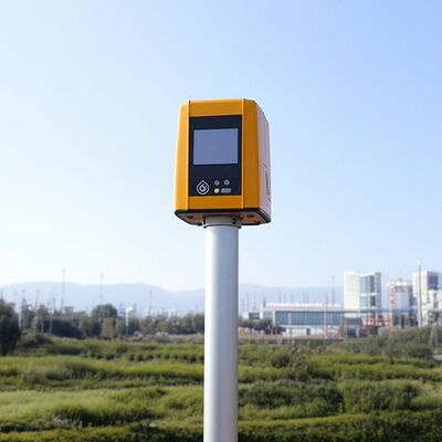
logo
บ้าน ผลิตภัณฑ์Doppler ลมลิดาร์

Vertical Range minus 10 to 190 degrees remote data collection tool featuring 4 kilometer vertical measuring distance tailored for industrial

ได้รับการรับรอง
จีน Nanjing Movelaser Co., Ltd. รับรอง
ความคิดเห็นของลูกค้า
ผมพอใจมากกับทัศนคติการบริการหลังการขาย คุณภาพของผลิตภัณฑ์เป็นเลิศ และฉันหวังที่จะยังคงรักษามัน

—— ลิยอง ซียอง

ผลิตภัณฑ์ของบริษัทของคุณแสดงผลงานที่ดีและคุณภาพที่ดีเยี่ยมระหว่างการใช้งานการให้การสนับสนุนอย่างแข็งแกร่งในกรณีเช่น การวัดลมในช่วงต้นของโครงการ และการประเมินการดําเนินงานของโครงการ; ทีมงานของคุณให้การตอบสนองในเวลาที่ถูกต้อง การสื่อสารที่มีประสิทธิภาพ และบริการที่ใส่ใจในการติดตั้งอุปกรณ์ การบํารุงรักษา

—— ยุนด้า ลี

หลังจากที่สินค้าพบปัญหาสามารถจัดการได้อย่างรวดเร็วหลังการขาย ขอแนะนำให้ทำให้ผลิตภัณฑ์เหมาะสมกับสภาพแวดล้อมมากขึ้น。

—— จีมินฟู

โดยรวมแล้ว ฉันพอใจมากและหวังว่าจะสามารถจัดหาอุปกรณ์เรดาร์ที่ล้ำหน้า เชื่อถือได้ และเสถียรให้กับเราต่อไป

—— ฟานหยาง

หวังว่าผลิตภัณฑ์จะได้รับการปรับปรุง ปรับปรุง และทำซ้ำอย่างต่อเนื่อง คุณภาพจะมีเสถียรภาพมากขึ้น และบริการ จัดส่ง และหลังการขายจะยังคงรักษาคุณภาพสูง และบรรลุระดับชั้นนำของอุตสาหกรรม

—— Yuwei Wang

การส่งมอบผลิตภัณฑ์การประมวลผลของอุปกรณ์เป็นไปอย่างทันท่วงที

—— หลงเฉิน

ทัศนคติเชิงบวกของบุคลากรทางการตลาด บริการหลังการขายอย่างทันท่วงที

—— ไคจ้าว

ทำงานหนักต่อไป ให้ความร่วมมือแบบ win-win

—— หยูหยานเซี่ย

อุปกรณ์และบริการดีมาก ฉันหวังว่าจะได้ร่วมมืออย่างต่อเนื่องในอนาคต

—— หมิงเจี๋ยโจว

อุปกรณ์นี้ติดตั้งง่ายและเหมาะสำหรับการทดสอบหน่วย

—— ลุค วัง

ฝาปิดกันลมจากภาคพื้นดินมีประสิทธิภาพที่ดีและได้รับการยอมรับจากผู้ผลิตเครื่องจักรภายในและเครื่องจักรที่สมบูรณ์ของเรา และไม่มีข้อโต้แย้งใดๆ ต่อผลการทดสอบ พนักงานขายมีความรู้ด้านเทคนิคและคำตอบอย่างมืออาชีพ พนักงานในสถานที่มีความกระตือรือร้นและหวังว่าจะได้ให้ความร่วมมืออีกครั้ง

—— คุนเผิงหลู่

ในบริการติดตั้งเรดาร์ เจ้าหน้าที่การตลาดมีทัศนคติที่ดี ความสามารถทางเทคนิคที่แข็งแกร่ง และแก้ปัญหาในสถานที่ ซึ่งให้การรับประกันที่มั่นคงสำหรับการขนส่งและการติดตั้งไลดาร์

—— เหลียงเกา

ระบบวัดลมนี้ได้เปลี่ยนวิธีการเก็บข้อมูลของเราไปอย่างสิ้นเชิง ความแม่นยำและความเสถียรยอดเยี่ยม แม้ในสภาวะที่รุนแรง ทีมสนับสนุนด้านเทคนิคมีความเป็นมืออาชีพอย่างยิ่ง!

—— เจมส์ เอ็ม.

ตั้งแต่ติดตั้งอุปกรณ์ LiDAR ของคุณ ประสิทธิภาพการประเมินฟาร์มกังหันลมของเราเพิ่มขึ้นอย่างน้อย 40% ไม่เพียงแต่เชื่อถือได้เท่านั้น แต่ยังใช้งานง่ายอีกด้วย ขอแนะนำอย่างยิ่งสำหรับทุกคนในวงการ!

—— โซเฟีย เฉิน

ความแม่นยําที่โดดเด่นและความทนทานที่น่าทึ่ง สถานีสนามของเราได้พึ่งพาการใช้อุปกรณ์นี้มานาน และมันไม่เคยทําให้เราผิดหวังการผสมผสานเทคโนโลยีที่ทันสมัย และการออกแบบที่ใช้ได้.

—— อาห์เหม็ด อัล-ฟาร์ซี

ในฐานะนักวิจัย ฉันต้องการความแม่นยําของข้อมูลสูงสุด ระบบนี้ได้เกินความคาดหวังทั้งหมด การบริโภคพลังงานที่ต่ําและการบูรณาการที่ง่ายดายได้เร่งกระบวนการของเราอย่างมาก

—— เอเลน่า โรสซี่

มีความมั่นคง, แม่นยํา, และเกือบไม่มีการบํารุงรักษา จริงๆแล้วเป็นคําตอบในระดับอุตสาหกรรมที่เราต้องการ มันช่วยให้เราปรับปรุงการผลิตพลังงานในขณะที่ลดต้นทุนการดําเนินงานอย่างมาก

—— โทมาส เฮเรร่า

จากการให้คําปรึกษาก่อนการขายถึงการฝึกอบรมทางเทคนิค ประสบการณ์การบริการได้เป็นอย่างดี อุปกรณ์ทํางานได้อย่างยอดเยี่ยม และให้ความรู้สําคัญสําหรับโครงการพลังงานลมของลูกค้าของเรา

—— ปริยา ชาร์มา

เราได้ทดสอบผลิตภัณฑ์ที่คล้ายกันหลายรายการ แต่ระบบนี้โดดเด่นในด้านเสถียรภาพในระยะยาวและความสอดคล้องของข้อมูล มันเป็นพันธมิตรที่เงียบในการตรวจสอบสิ่งแวดล้อมอย่างแท้จริง

—— Björn Lundgren

สนทนาออนไลน์ตอนนี้ฉัน

Vertical Range minus 10 to 190 degrees remote data collection tool featuring 4 kilometer vertical measuring distance tailored for industrial

Vertical Range minus 10 to 190 degrees remote data collection tool featuring 4 kilometer vertical measuring distance tailored for industrial

ภาพใหญ่ :  Vertical Range minus 10 to 190 degrees remote data collection tool featuring 4 kilometer vertical measuring distance tailored for industrial

รายละเอียดสินค้า:
ชื่อแบรนด์: MOVELASER
Model Number: 3D Scanning Doppler Wind Lidar Molas 3D
การชำระเงิน:
Minimum Order Quantity: 1 Set
Packaging Details: Air Box
Delivery Time: 1-2 Months
Payment Terms: L/C, D/A, D/P, T/T
Supply Ability: 200 Set ,1 Month
รายละเอียดสินค้า
Size: 756mm*735mm*1000mm Sight Detection Distance: 10km
Maximum Acquisition Distance: 15km Distance Resolution: 15m/30m/75m/120m
Sight Wind Speed Accuracy: 0.1m/s Weight: ≤100kg
Pointing Acuracy: ±0.005° DataStorage Time: 5to18months
เน้น:

Doppler Wind Lidar remote data collection

,

Doppler Wind Lidar 4km measuring distance

,

Doppler Wind Lidar industrial vertical range

Product Description:

Molas 3D is an advanced Doppler wind measurement lidar that operates using three-dimensional scanning technology. It utilizes the principle of pulsed laser coherent Doppler frequency shift to accurately capture wind speed data.

This innovative device supports multiple scanning modes, including P-Pl, RHI, DBS, and program scanning. Such versatility allows it to be tailored for specific wind speed measurement requirements across various applications.

The Molas 3D lidar is well-suited for a wide range of customized scenarios. These include offshore wind resource assessment, research in complex terrains, wind turbine wake detection, and airport glide path wind shear warnings. Additionally, it is valuable for urban meteorological observations and detecting high-altitude turbulence.


Features:

Comprehensive Measurement Capabilities

The system offers detailed measurement information by utilizing a refined 3D wind field measurement technique. It supports up to 300 customizable distance layers, allowing for precise and tailored data acquisition.

Wide Detection Range

Equipped with a large detection range, the device can monitor sight distances up to 10 kilometers, particularly effective at altitudes below 600 meters.

High Accuracy Performance

This technology ensures exceptional precision, featuring a pointing accuracy of 0.005 degrees and a visual direction wind speed accuracy of 0.1 meters per second.

Diverse Scanning Methods

Multiple scanning techniques are supported, including PPl, RHl, DBS, and a programmable arbitrary scan method, allowing for versatile operational modes based on varying measurement needs.

Flexible and Lightweight Deployment

Designed to be small and lightweight, the system facilitates easy transportation and rapid deployment in different environments.

All-Weather Durability

Built to withstand harsh outdoor environments, it offers survivability in LPz0 and features lightning protection zones, ensuring reliable operation regardless of weather conditions.

Safety and Security Features

Safety is paramount, with integrated GPS location reporting and geo-fencing capabilities. Additionally, data encryption safeguards against any risk of information leakage.

Multiple Configuration Options

Users can select from four distance resolutions and five accumulation times, providing flexibility to tailor the system’s operation to specific requirements.


Technical Parameters:

Vertical Range -10~190°
Sight Detection Distance 10 km
Sight Wind Speed Range -75~+75 m/s
Distance Resolution 15 m / 30 m / 75 m / 120 m
Sight Wind Speed Accuracy 0.1 m/s
Distance Layers Up to 300
Pointing Accuracy ±0.005°
Accumulation Time 0.2~10 s (Optional)
Data Storage Time 5 to 18 months
Vertical Measuring Distance 4 km

Applications:

Wind resource assessment involves collecting wind field data over extensive areas, which helps to minimize the risks associated with site selection for wind energy projects. By accurately measuring wind parameters, it ensures better planning and utilization of wind resources.

Long-distance power curve measurements and wake eddy current assessments play a significant role in optimizing wind energy utilization. These measurements contribute to improving the efficiency of wind energy units by providing detailed insights into wind flow dynamics and turbine performance.

Early detection and warning systems are essential for identifying dangerous meteorological phenomena, such as wind shear and microbursts. Timely warnings can enhance safety measures in aviation and other weather-sensitive operations.

Measuring wake vortices is crucial for optimizing flight separation at airports. By understanding these vortices, air traffic controllers can better manage aircraft spacing, thereby increasing airport traffic efficiency and safety.

Providing detailed wind field information aids in understanding the behavior of wind within the atmospheric boundary layer. This data is vital for meteorological studies and improving weather forecasting models.

Accurate and high spatiotemporal wind profile measurements near the surface, within a few kilometers, help fill the observation gaps at low altitudes. This enhanced data resolution supports various applications ranging from environmental monitoring to renewable energy development.

Real-time three-dimensional information about plume dispersion enables effective tracking of emission sources. Such monitoring is particularly valuable for environmental management and controlling air pollution.

Additionally, optimizing dust emission control in the mining industry relies on precise wind and dispersion measurements. These techniques help minimize environmental impacts and enhance operational safety in mining activities.


รายละเอียดการติดต่อ
Nanjing Movelaser Co., Ltd.

ผู้ติดต่อ: Miss. ivyyao

โทร: +86 13072523225

แฟกซ์: 86-025-86800073

ส่งคำถามของคุณกับเราโดยตรง (0 / 3000)

ผลิตภัณฑ์อื่น ๆ